
TomTom has launched an On-Street Parking service to help drivers on the hunt for that hard to find parking spot.
TomTom
TomTom wants you to star in a short film
TomTom is calling on drivers around the world to get involved in a short film celebrating life on the road.
TomTom launches new affordable Start series sat nav
UK Traffic congestion is on the rise
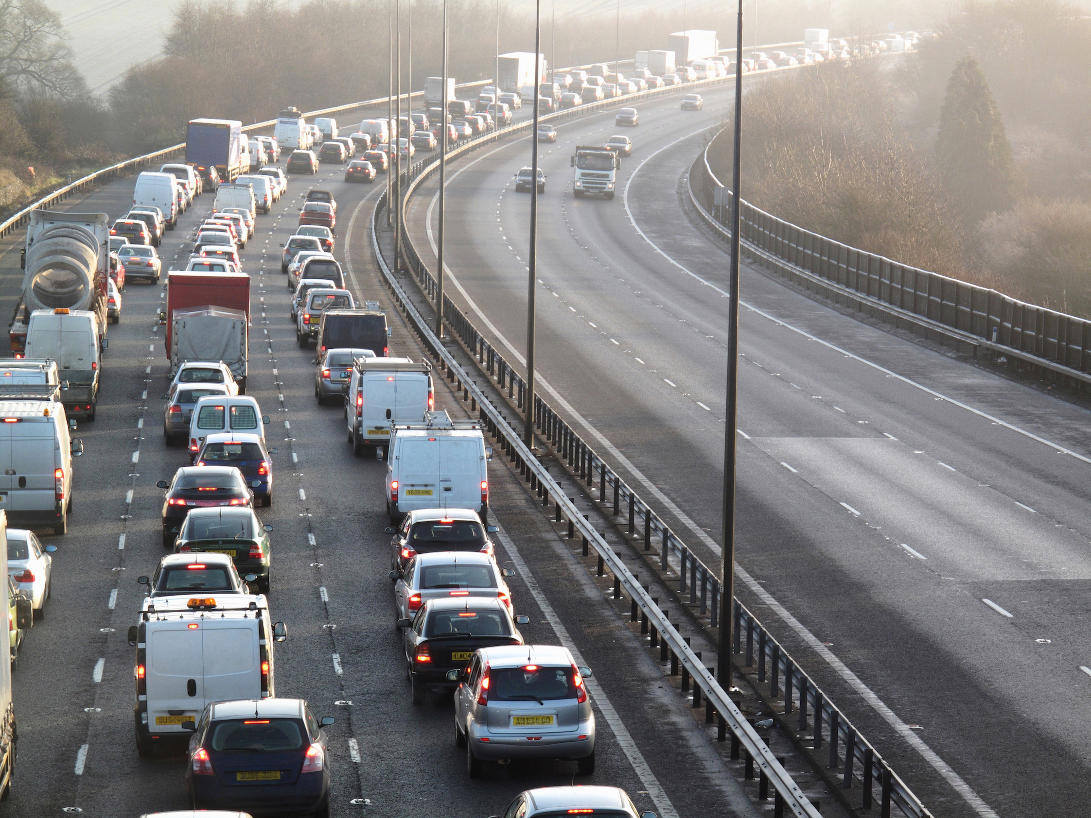

Traffic congestion in the UK’s biggest cities is 14 per cent worse than it was just five years ago.
That’s according to the annual Traffic Index from TomTom which shows across the rest of Europe, average congestion is actually 3 per cent down over the same period.
The annual Traffic Index shows average UK journeys in 2015 took 29 per cent longer than they would in free-flowing conditions – up from a 25 per cent delay in 2010. The analysis of 14 trillion pieces of traffic data worldwide showed that the morning rush hour is almost 10 per cent more congested than in 2010, with the evening peak nearly a fifth (19 per cent) worse – suggesting that people return home in a narrower time period in the evenings.
The average commuter driving to and from work in the UK’s top 25 cities wasted 127 hours (more than 5 whole days) stuck in traffic during 2015. Congestion has got 4 per cent worse in the past year alone. It’s risen in 17 of the 25 UK cities in the report, with a further 4 remaining about the same. Only Nottingham, Portsmouth, Middlesbrough and Preston have shown slight decreases.
In 295 cities globally Belfast was once again the most congested city in the UK – and 14th worst in the world. Journey times in 2015 were 40 per cent slower than free-flow traffic throughout the day – peaking at 86 per cent longer in the evening rush hour.
London is the 20th most congested city worldwide – and second worst in the UK - with journey times 38 per cent slower, rising to 66 per cent in the evening peak. The Northern Powerhouse of Manchester (37 per cent slower) moves up into third place, overtaking Edinburgh (37 per cent) and Brighton (34 per cent). The next five worst cities for congestion are Hull, Bournemouth, Newcastle, Bristol and Sheffield.
“Transport authorities are managing congestion with well-engineered policies, but you can’t just build your way out of traffic jams” said Ralf-Peter Schaefer, Vice-President of TomTom Traffic. "Studies have shown that policies of ‘predict and provide’ are unsustainable. Building new motorways and ring roads doesn’t eliminate congestion. More must be done to better manage existing road space and to spread demand.
“People simply aren’t doing enough to change their travel habits - such as working flexible hours, avoiding peak commuting times, making use of real–time traffic information and trying alternative travel modes. If only five per cent of us changed our travel plans, we could improve traffic congestion on our main roads by up to thirty per cent”.
Globally, Istanbul has been knocked off the top spot by Mexico City. Commuters in the Mexican capital can expect to spend 59 per cent extra travel time stuck in traffic during the day, rising to 94 per cent in the evening peak period – a total of 219 wasted hours a year. The next most congested big cities worldwide are Bangkok (57 per cent), Istanbul (50 per cent), Rio de Janeiro (47 per cent) and Moscow (44 per cent).
TomTom has been collecting traffic data since 2008 and over that period, the UK city that has recorded the largest overall growth in congestion is Coventry - up a staggering 67 per cent. Stoke-on-Trent has seen the biggest increase in rush hour congestion, at 44 per cent. But Cardiff can give itself a pat on the back, with overall congestion down 19 per cent since 2008.
The TomTom Traffic Index is the only global measurement of congestion comparing travel times between non-congested hours and rush hour periods, for passenger vehicles. It takes into account local roads, main roads and motorways across 295 cities in 38 countries on six continents.
Bosch and TomTom partner on maps for automated driving
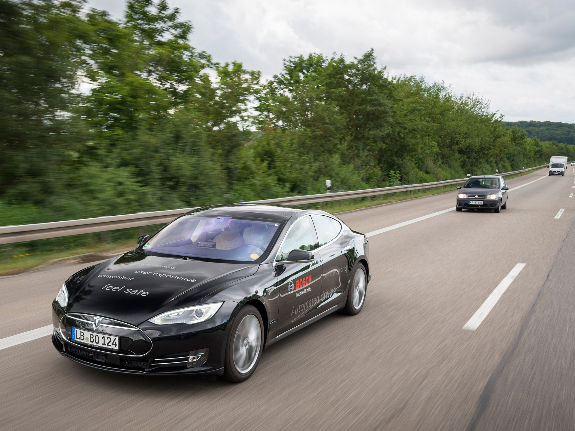
TomTom and Bosch are to collaborate on the development of mapping technology for highly automated driving.
Under the agreement, TomTom is designing the maps, while Bosch is defining the specifications they have to meet. The maps are already being used in automated vehicles Bosch is testing on certain public roads in Germany (A81) and in the United States (I280).
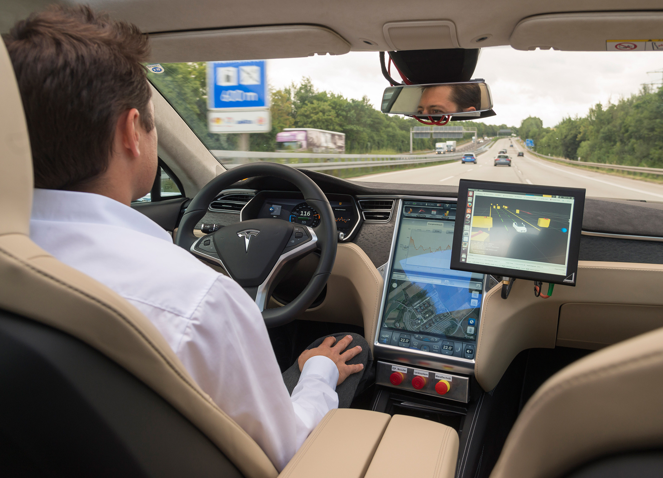
Maps for highly automated driving differ primarily from those used in current navigation systems in two respects. Firstly, accuracy is significantly higher - down to decimetre precision. Secondly, the map material required for highly automated driving consists of multiple layers.
The traditional base navigation layer is used to calculate routes from A to B, including the sequence of roads to be driven. The localisation layer uses a novel positioning concept providing highly accurate map data, which the automated vehicle uses to accurately calculate its position within a lane. To do this, the vehicle compares its sensed environment with the corresponding information in the localisation layer. In this way, it can accurately define its position relative to the road and its surroundings. On top of the localisation layer, the planning layer contains not only attributes such as lane divider types, traffic signs, speed limits, etc., but also 3D information about road geometry, including curves and slopes. With the help of this very detailed lane information, the automated vehicle can decide things such as when and how to change lane.
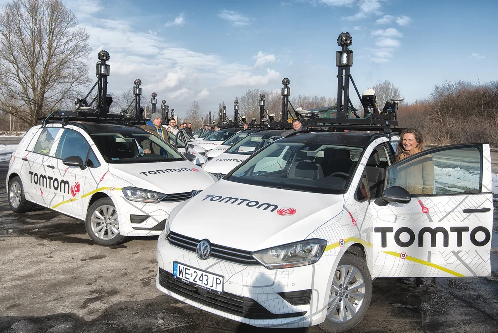
In highly automated driving, safety and comfort depend crucially on map material that is up to date. For example, up-to-the-minute speed-limit information has to be available instantly. Only then can vehicles select the best proactive driving strategy. In this regard, Bosch and TomTom rely on several elements and services to keep the map data up to date: the TomTom mapping fleet will continue to be regularly on the road, accurately mapping new roads and routes. And to register recent changes on the roads, such as changed lane configurations or new traffic signs, TomTom and Bosch plan to use feedback from fleets of vehicles equipped with the necessary sensors. Information about changed road conditions captured this way will be transferred to a server, verified, and entered in the digital map database. The updated map will then be fed back to the highly automated driving vehicle, enabling it to see effectively beyond its sensors.
Commenting on the importance of the venture, Bosch board member Dr Dirk Hoheisel said: "Only with high precision maps will automated driving on freeways be possible from 2020." And Jan Maarten de Vries, Vice President Automotive at TomTom, added: "By the end of 2015, we want to have new high-precision maps for automated driving for all freeways and freeway-like roads in Germany." Road coverage will subsequently be extended to the rest of Europe and North America.
For Bosch and TomTom, this collaboration in the area of maps for highly automated driving is an extension of an already existing partnership on Bosch's connected horizon, for which TomTom also provides dynamic map information via their real-time service backend - albeit without any localisation layer.